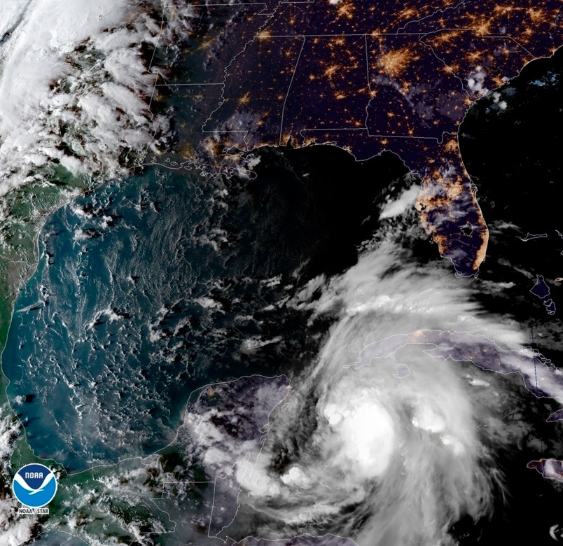
MIAMI (AP) — A tropical weather system that rapidly strengthened into Hurricane Michael on Monday is likely to intensify ahead of an expected strike on Florida’s Panhandle by midweek, forecasters said.
Michael could strengthen into a major hurricane with winds topping 111 mph (178 kph) by Tuesday night before an expected strike on the Panhandle or Big Bend, according to the National Hurricane Center.
Since the storm will spend two to three days over the Gulf, which has very warm water temperatures and favorable atmospheric conditions, “there is a real possibility that Michael will strengthen to a major hurricane before landfall,” Robbie Berg, a hurricane specialist at the Miami-based storm forecasting hub, wrote in an advisory.
Florida Gov. Rick Scott issued an order for a state of emergency for 26 counties to rush preparations, freeing up resources and activating 500 members of the Florida National Guard.
By mid-morning Monday, a large mound of sand in Tallahassee had been already been whittled down to a small pile as residents tried to prepare for potential flooding. A city of Tallahassee worker promised that another mound was ordered and on its way.
“All indications are that it’s going to be severe,” said City Commissioner Gil Ziffer, adding that if the storm hits Florida’s capital, there would be significant tree damage and power outages. “Hopefully we will have no one hurt and no loss of life.”
Two years ago, Hurricane Hermine knocked out power for days in Tallahassee and caused widespread flooding as it came up through the Gulf Coast.
Tallahassee Mayor Andrew Gillum, who is the Democratic nominee for governor, had planned to campaign in South Florida on Monday and Tuesday, but he said he would return to the city to help with storm preparations.
Farther west along Florida’s Panhandle, the city of Pensacola tweeted to residents, “Be sure you have your emergency plan in place.”
By 11 a.m. Monday, Michael’s top sustained winds were around 75 mph (120 kph).
The storm was centered about 50 miles (80 kilometers) off the western tip of Cuba, and about 140 miles (220 kilometers) east-northeast of Cozumel, Mexico. It was moving north around 7 mph (11 kph).
Michael was lashing western Cuba late Monday morning with heavy rains and strong winds, according to the hurricane center. Forecasters warned that the storm could produce up to a foot (30 centimeters) of rain in western Cuba, potentially triggering flash floods and mudslides in mountainous areas.
Hurricane-force winds extend outward up to 30 miles (45 kilometers) from the storm’s center and tropical-storm-force winds extend outward up to 175 miles (280 kilometers).
Hurricane Center Director Ken Graham said the storm’s large size, strong winds and heavy rains could produce hazardous flooding along a stretch of Florida’s Gulf coast that has a lot of rivers and estuaries where seawater being pushed ashore by a hurricane could get trapped.
“This is a part of the Gulf of Mexico that is incredibly vulnerable to storm surge,” Graham said.
Parts of Florida’s curvy Big Bend could see up to 12 feet (3.5 meters) of storm surge, while Michael also could dump up to a foot (30 centimeters) of rain over some Panhandle communities as it moves inland, forecasters said.


