Nevermind Apple’s maps misfire, the free, volunteer-made OpenStreetMap, may end up reigning supreme anyway, as companies increasingly choose it for map data over Google. But as the project grows, it’s becoming harder and harder for its members to agree on what direction to go in next. Part 1 in a 3-part series.
OpenStreetMap, a free crowdsourced online world map started eight years ago, has seen its ranks swell to over 800,000 volunteer mapmakers around the world — 300,000 in the last year alone — rapidly becoming the go-to source of map data for successful tech brands including Apple, Foursquare and Wikipedia, as well as for government agencies like the National Parks Service, all of whom are wary of Google’s decision to begin charging for heavy use of its Maps API starting in January 2012.
But as the project grows and matures, it’s facing a whole new set of challenges, the biggest of which is the question of whether or not to commercialize and move away from its open source roots.
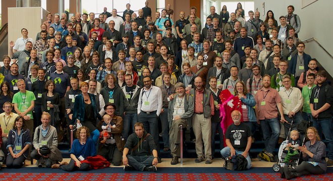
The tensions facing the community were on full display at OpenStreetMap’s annual “State of the Map USA” conference in Portland, Oregon from October 13 through 14, a frenzied, jam-packed series of over 50 presentations and countless other informal talks between avid geographers and programmers who sprawled over a few generally overcrowded rooms at the Oregon Convention Center, fueled by coffee (beer at night) and their boundless enthusiasm for using and improving the vast and increasingly vital public map.
This was only the second-ever U.S.-specific State of the Map, yet, in testament to the project’s recent burst of popularity, attendance was 225, up from just 40 people at the initial American conference in Atlanta, Georgia, in 2010.
Here’s a video played at the start of the conference. Created by UK transportation map services company ITO World, it shows all of the edits made to OpenStreetMap in the continental U.S. stretching back to 2007, when the project really took off here thanks to a massive import of public data from the U.S. Census Bureau’s TIGER (Topologically Integrated Geographic Encoding and Referencing) program:
The New Cartographers
Mapmaking is one of humanity’s oldest arts. The earliest maps of the Earth date back to prehistory, 14,000 years ago, where explorers discovered a map scrawled on a stone tablet in a cave in Spain in 2009.
“One can argue that man’s need to make maps arose during a fairly early stage in the coevolution of brain and culture,” wrote G. Malcolm Lewis, reader in Geography at the University of Sheffield, England, in the “Origins of Cartography.”
By the early 16th century, when Italian explorer and cartographer Amerigo Vespucci leant his name to what was then the New World (“America”), after proving it was not connected to Asia or India (contrary to Christopher Columbus’ hopes), mapmaking had become an institution.
“Mapmakers were always these people who were very lauded,” said Eric Wolf, a geographer with the United States Geological Survey (USGS), in a presentation at the State of the Map USA conference in Portland on Saturday. “We make fantastic drawings about these people, we name companies after them, we put them on stamps.”
There was a elitist bent to the art in the 20th century, too, when mapmaking was done first by explorers as agents of governments, then government agencies like the USGS, established in 1879.
But in the late 20th century, with the advent of new technologies including satellite imagery and computers, something interesting happened: Mapmaking transitioned to dedicated commercial geographic information systems companies, Wolf noted, including names like Navteq and TeleAtlas.
These companies, in turn, were subsumed by other companies that didn’t specialize in mapping and were in many cases involved in wholly different industries. Navteq, for instance, was acquired by Finnish phonemaker Nokia, while Dutch company TomTom acquired TeleAtlas for use in GPS navigational devices.
“Today we have this whole other cast of characters: Google, Bing, Mapquest, Apple,” Wolf said. “The point is that mapping has pretty much always been this activity of ‘them — the experts.’ But these are the new mappers: They’re just ordinary people. They’re us.”
So in the history of humanity, it’s safe to say that there’s never a mapping project quite as ambitious as OpenStreetMap, a world map that nearly a million collaborators around the world have signed up to work on; that gets updated in real time, all the time; that anyone can access for free, whenever they want.
Here’s the official chart showing OSM’s total contributors spike in the past few years:

Brave new world map
Indeed, since OpenStreetMap (OSM) was first proposed in 2004 by then 24-year-old English computer scientist named Steve Coast, and after the project’s first online map editing software came online in 2006, it’s been possible for anyone with an Internet connection to edit, add new places to and improve a free digital map of the globe.
“This is all Steve’s fault,” said Richard Welty, formerly the president of the OpenStreetMap USA chapter in introductory remarks at the conference. “You wouldn’t be here today if it weren’t for Steve.”

Welty stepped down during the conference per the OpenStreetMap Foundation’s own one-year board membership terms. He was later spotted by TPM at the conference talking to representatives from Foursquare about a job.
“We have this tradition in Britain of supporting the underdog,” Coast said during his keynote address at the conference. “OpenStreetMap is very much the underdog compared to our propriety brethren.”
Indeed, OSM’s origin story is in many ways the embodiment of the quintessential “from humble beginnings.”
“We started with absolutely nothing, a completely blank canvas,” Coast told The Guardian’s Sunday Observer earlier in 2012, “The first data came from me cycling around Regent’s Park with a GPS puck the size of a pack of cards and then plugging it into my laptop.”
But while that may have been the case, Coast himself has gone through several commercial re-inventions. He co-founded his own for-profit company, CloudMade, in 2008, specifically with the aim of “packag[ing] the [OpenStreetMap] data for third-party use,” that is, for use by other for-profit companies.

Coast resigned from the company in 2010 after it failed to turn a profit for its two years, despite millions in venture capital investment, and after some volunteer contributors to the OpenStreetMap became upset with CloudMade’s idea to make money off their labor.
Coast quickly rebounded and took a job at Microsoft as the principal architect on search engine Bing Mobile in late 2010, a position he’s held ever since.
Between 2009 and 2012, Coast was also Chairman of the OpenStreetMap Foundation, the nonprofit entity created in 2006 to manage the server space on which all of OpenStreetMap’s collective data is stored. But Coast stepped down from this role in August 2012 and was voted “Chairman emeritus,” a role that’s far more than merely ceremonial: He has a standing invitation to all future State of the Map conferences, is asked to advise and opine on the direction of OpenStreetMap going forward and is supposed to represent the project in public appearances.
Coast fulfilled all of these roles simultaneously during the course of the 2012 State of the Map USA conference, but it was in the opining and advisory parts that he caused the most commotion, calling for a new, separate conference in 2013 limited to commercial users of OpenStreetMap only, such as Foursquare and MapBox, a D.C.-based for-profit startup that builds open source and proprietary products from OpenStreetMap data, which also helped sponsor and organize the conference.


