While Apple is still sorting out its own maps disaster here on Earth, others are busy mapping the worlds beyond.
Take NASA’s Mars Curiosity Rover, which on Wednesday posted the first interplanetary “check-in” on Foursquare, the popular geolocation social website.
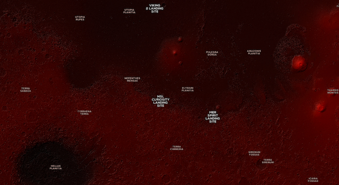
The rover’s check-in would not have been possible without a beautiful, accurate digital map of the Red Planet created as a side project in just a week by someone outside of both Foursquare and NASA.
Chris Herwig, a data analyst at digital mapping company Mapbox, told TPM in an email that he was inspired to create his map of Mars on the weekend of August 4, a few days before NASA’s Mars Curiosity Rover actually nailed its perilous landing.
“Over the weekend around the launch I started looking into what data there was,” Herwig explained. “I had a pretty basic question in mind when I started: ‘What did Mars actually look like?'”
Herwig’s resulting map does much to answer his original question: Created in a week using entirely open-source tools, including MapBox’s own TileMill map design software with public data of the surface of Mars provided by NASA, the U.S. Geological Survey (USGS) and the International Astronomical Union, the map, available online here, shows not only the various named geologic features of Mars, but also all of the lander missions successfully sent to Red Planet by the U.S. and Russia since 1971.
Though Mars is nicknamed the Red Planet, Herwig actually made two different colored versions of the map, including one shaded a variety of hues representing variations in Mars topography. See that view here:
“USGS and NASA, by a long shot, have the best documentation I’ve seen,” Herwig told TPM. “This made it pretty easy for me, someone with no astronomical experience whatsoever, to step in and build on the great work they had already done.”
As easy as it was, Herwig still had to overcome a challenge almost as old as mapmaking itself: How to represent a spherical world on a flat, 2D surface.
“There is nothing easy about trying to make an orange peel spread flat on the table,” Herwig said. “Using the right source projection for the datasets was critical, and the cause of some frustration.”
Still, in the end, Hewig’s maps were good enough to serve as the basis of NASA’s collaboration with Foursquare.
“We got the map from MapBox, the provider we use for all of our maps on the web,” a Foursquare spokesperson confirmed to TPM.
“The funny part there is that Foursquare reached out to us not even knowing” that Herwig was building a Mars map, he said. “That is how things tend to work at MapBox, some’s weekend playing can quickly turn into a full on sponsored project. It’s a kind of different work life balance.”
Foursquare in February switched from using Google Earth to power its users’ geo-tagged check-ins to Mapbox’s digital maps of Earth.
Mapbox’s Earth maps use data compiled by OpenStreetMap, a free crowd-sourced world mapping project that now includes over 800,000 volunteer cartographers around the world.
Asked how Herwig’s map of Mars stacks up to Google’s own Google Mars map, he told TPM that they both relied upon the same elevation dataset compiled by the the Mars Orbital Laser Altimeter (MOLA), an instrument on the now defunct NASA Mars Global Surveyor satellite, which was active from 1996 to 2006, the longest operating spacecraft over Mars in human history. It’s MOLA instrument captured Mars surface data a resolution of 463 meters per pixel.
The spacecraft’s legacy now lives on through Herwig’s open source work. And as NASA continues driving the Mars Curiosity Rover around the surface of the Red Planet, conducting experiments and checking-in, Herwig told TPM he plans to continue updating his map of Mars with more accurate data.
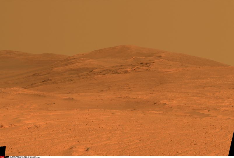
“I’m going to be integrating some of the high-resolution orthoimagery from the University of Arizona’s HiRISE Camera, which returns images of Mars at a resolution of 25 centimeters, better than what you can get for a large portion of Earth,” Herwig said. “This is exciting and big data. Equally exciting will be to include the Rover’s on-the-ground images, which offer perspectives you just can’t get from a satellite orbiting around the planet.”
But Mars isn’t the only otherworldly place Herwig is looking to map.
“Lately I’ve been interested in Titan, one of Saturn’s moons, which is thought to have a subsurface ocean,” the data analyst told TPM. “I am fundamentally confused as to how that’s possible — so I will map it.”


