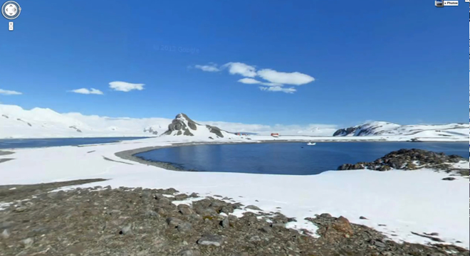
Google released new 360-degree views of select sites in Antarctica on Tuesday for Google Street View, allowing Web users to virtually navigate the frozen continent.
“The goal of these efforts is to provide scientists and travel (or penguin) enthusiasts all over the world with the most accurate, high-resolution data of these important historic locations,” wrote Google Street View technical manager Alex Starns in an official Google blog post announcing the new imagery, which includes virtually navigable views of sites such as the South Pole Telescope, Shackleton’s Hut, Scott’s Hut, Cape Royds Adélie Penguin Rookery and the Ceremonial South Pole.
Google published the following video on Monday highlighting the new views:
The new imagery of Antarctica isn’t the company’s first, however: Google originally published Street View panoramas of a few penguin-heavy areas of the continent back in 2010.
Google’s Starns said that the new imagery was captured using “a lightweight tripod camera with a fisheye lens,” as opposed to Google’s other, more well-known method of collecting Street View shots, using its conspicuously camera-adorned cars.
Google has been investigated by several governments for collecting people’s Web usage data over WiFI without their knowledge using Street View cars over a three year period, which Google said was a mistake. But it’s content like this that shows off the power of Google’s digital mapping efforts, and its advantage over rival mapping companies, including Apple’s own new maps and OpenStreetMap, a free crowdsourced alternative, neither of which offer Google’s Street View technologies or comparable alternatives.


